Changing Agricultural Landscapes
Transforming Agricultural Landscapes - From Hispania to al-Andalus
Often overlooked, but literally ‘ground-braking’ is agriculture. The way a society shapes its landscape and rural villages mirror the society at large. Of course, this is not easily to discern for a pastoral passer-by.
Why is landscaping agriculture important for historians? Why to listen to this back-to-back lecture? There are several reasons:
- Property Rights: Pre-modern society generate their wealth up to 90% by farming and husbandry. Law is at work, and the distribution of wealth becomes visible in the ‘fields’ and in forms of agricultural settlements.
- Farming Techniques: Water supply and irrigation are fundamental for the success of the countrymen. Water distribution touches law, engineering techniques, and of course economic investments in them.
- Size and Produce: The visible use of the land distinguishes industrial agriculture versus small farms, provide information about the labor force, free farmers, employed landless population, or slaves.
- Dietary: The products mirrors the dietary preferences and thus demand of the society, grain or fruits, fields or garden, ox and pigs or sheep.
- Settlements: Rural settlements mirror the society living in them directly.
The Roman world had its distinguished feature to produce on an industrial scale. The Monte Testaccio in Rome, with its disposed oil-amphorae, is a visible monument of this.
With the Visigoths, a new landholding class came to Hispania which was then severed from much of the Cross-Mediterranean trade. After the Muslim Conquest, a complete new population, with different backgrounds in agriculture and husbandry came settled in the now al-Andalus, forming landscape and villages. How did the change in ownership, law, irrigation techniques and dietary preferences, and social composition alter the landscape and the habitats?
Archaeology of landscapes and rural sites is a way to answer these questions and with these issues in mind to understand the transcultural changes on the Iberian Peninsula, we are looking forward to listen to:
Roman Agriculture and Landscape in Hispania: An Archaeobotanical Perspective from its Western Fringe by Dr. João Pedro Tereso (UNIARQ - Centro de Arqueologia da Universidade de Lisboa)
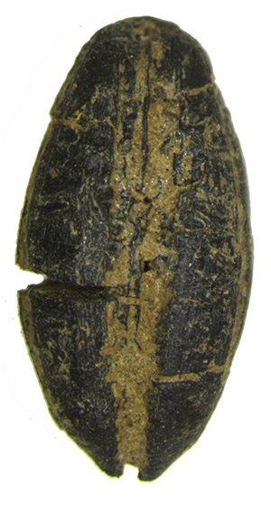
The Roman conquest imposed several changes in the landscape and socioeconomic structures of indigenous communities all over the Empire. While plenty archaeological investigation in Iberia focused on the territorial aspects of such changes, addressing the establishment of new cities as well as villae and farms of different sizes to supply them, until recently research seldom focused on the actual crops that were consumed and cultivated. Archaeobotanical research plays a crucial part in this matter, but the number of Iberian Roman sites with proper studies was strikingly low, compared to other periods.
The B-Roman project tried to fill this gap in one of the least studied provinces in Iberia, the Lusitania, by conducting analyses in several sites in Portugal and Spain. The carpological record will serve as the starting point for a discussion which will include information on settlement and vegetation changes. The data gathered suggests people began relying on a wider range of fruits that were not commonly found in that area before. It also shows similarities between Lusitania and the Mediterranean Hispanic provinces, rather than with the northwest. Although there may be some biases in the archaeological record, the differences are likely due to environmental variations from south to north. However, social and economic factors may also have contributed to these differences.
Furthermore, agricultural development had a relevant impact in vegetation dynamics in the region. The Roman conquest occurred in already highly humanized and deforested landscapes, but agriculture and animal husbandry enhanced even further the tendency for forest loss and soil degradation. Whether this played a part in changes in crop choices in the late Antiquity is a matter of debate.
Dr. João Pedro Tereso is an archaeologist who specializes in Archaeobotany. Currently, he is an Assistant Researcher at CIBIO-BIOPOLIS and an Invited Assistant Professor at the University of Coimbra. With a degree in Archaeology and a PhD in Biology, he has conducted research in over 100 archaeological sites, mostly from Portugal and Spain, authored 120 publications and nearly 200 communications in scientific events.
His research is primarily centred on the relation between environmental changes, the evolution of agriculture, and social trends in different timespans. His focus has been mainly on the period from the Bronze Age to Medieval times in Iberia, with particular attention on the Iron Age and Roman Period in western Iberia.
Cuatrovitas (Bollullos de la Mitación, Prov. of Seville, Spain): New Investigations Into the Almohad Mosque and Abandoned Village by Dr. Heike Schneider (Universität Jena) & Dr. Anja Heidenreich (Universität Bamberg)
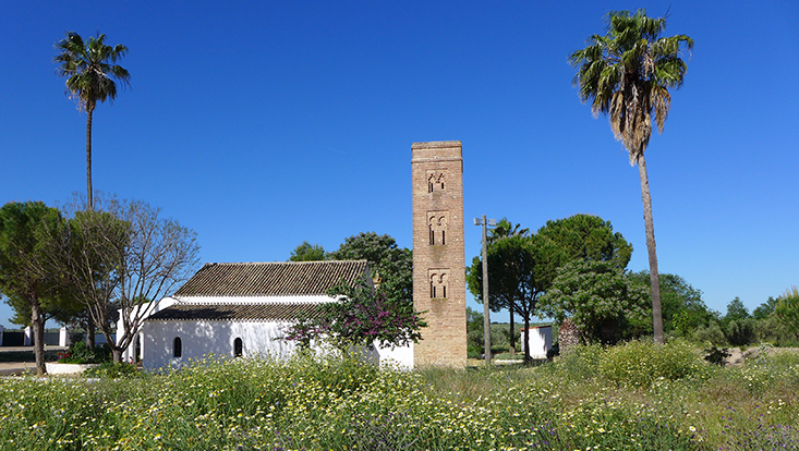
In al-Andalus a deserted Islamic settlement near Seville has been investigated by archaeologists from the universities of Bamberg and Seville. This place named the “hermitage of Cuatrovitas” is well known for its exceptionally well-preserved minaret, standing next to the former mosque (now pilgrimage church). The oldest finds date back to the Roman period, although an intense use of the local settlement could be only traced for Islamic times and later. At the center of the abandoned village the main mosque was located, which survives today in an almost complete state, although it has since been repurposed as a church. Surrounding the building are large open areas, now used for modern agriculture, which were partly inhabited until the late Middle Ages, even after the Christian conquest around 1248. The investigations began with a four-week campaign at the end of October 2013 and continued until the end of 2018, with a focus on natural scientific disciplines.
In terms of Islamic archaeology, we pursued two fundamental approaches during the project:
a) an intensive study of the building and its components (prayer hall, minaret, courtyard), including identifiable construction phases and their technical and stylistic characteristics. This included the use of 3-D scans of the standing structure and ground-penetrating radar surveys of the floor areas inside the building and in the former courtyard. Observations of the rising masonry and archaeological soundings in selected foundation areas complemented the architectural research. Through a mathematical-metrological analysis based on a precise building plan, we also obtained information about the consciously chosen proportions of the building in Almohad measurements, its planning, and its construction materials.
b) Questions regarding the morphology and cultural-historical significance of the site, including the reasons for its gradual decline from the mid-13th century onward, formed the second focus of the research. For a region that was likely shaped by specialized agricultural practices even then, interesting approaches emerged for reconstructing the cultural landscape and its transformation under the conditions of the Christian conquest.
A large-scale geophysical survey of the surroundings, combined with a survey of the still-visible ceramic scatter on the surface, revealed the historical extent of the site. By processing the data in ArcGIS, we were able to determine the extent and core areas of two large Almohad settlements. In addition to the classic archaeological excavation, various natural scientific investigation methods were applied. These included the anthropological analysis of burials found around the church, the paleozoological analysis of animal bones, a study of the ceramic finds, selected age determinations through C-14 dating, and isotopic analysis of bone material.
Comparative palynological studies in the settlement and the contact zone of the Doñana system as well as geomorphological analysis allowed the reconstruction of vegetation and cultural landscapes since Phoenician time, for which there had been no previous studies in Aljarafe. The palynological investigations show, that the landscape in the Aljarafe region has intensively been used before the Islamic colonization by Phoenician, Kelt-Iberian as well as Roman and Visigoths’ people occupied this area. A clear increase in agricultural land use is already visible in the early Islamic period up to 711 cal. AD. Between 850 and 1000 cal. AD a first decrease in settlement activity is visible and could point to changes in the political system or to the migration of people from countryside to the cities. The culmination in land use with animal husbandry and cultivation of crop, grapes and olives is visible in the period between 1000 and 1250 cal. AD, which is also marked by regularly occurrence of Lamiaceae (Lavendula spec.). Starting at 1250 cal. AD a slow but consequent decrease in land use is notable, which indicates the land management by the muslimic farmers under Christian control in the first decades after the Reconquista, before Christian farmers used the land or even abandoned it. The development changed around 1600 cal. AD with a clear rise in animal husbandry and was accompanied by a massive increase in arable farming around 1800 cal. AD.
All results were published in monographic form in both German and English.
In our joint presentation, we aim to explain the results of both the archaeological research and the pollen analysis on the topic of local settlement changes.
 Dr. Anja Heidenreich is currently working at the Institute of Islamic Art and Archaeology in Bamberg. Having focused for many years on the analysis of Islamic ceramics, she prefers to incorporate practical aspects into her teaching. This includes hands-on experience with ceramics and finds for her students, applying new technical approaches during excavations, processing material from these finds, and organizing museum exhibitions, such as the recently closed "Light in Islam" exhibition at the Bumiller Collection in Bamberg.
She has collaborated with Prof. Lorenz Korn for nearly two decades, conducting research and fieldwork in various countries across the Orient, including Iran, Syria, Jordan, and India. Recently, an intensive collaborative project in Andalusia concluded with a monographic publication. The results of this multi-layered approach, which included methods such as palynology, focused on the abandoned medieval settlement of Cuatrovitas and form the basis of the contribution presented at the RomanIslam Center. The presentation is shared with Dr. Heike Schneider from the University of Jena.

is currently working at the Thuringian State Office for Monument Preservation and Archaeology with a lectureship at the Department of Physical Geography at the Friedrich Schiller University Jena. She earned her Diploma in Biology in 1996 and her PhD in Physical Geography from the Friedrich Schiller University of Jena in 2001 working with Prof. R. Mäusbacher and Dr. A. J. Kalis (Goethe University Frankfurt/Main). In her thesis work she investigated the late and postglacial vegetation history of the middle Werra valley in Thuringia.
After completing his PhD, Heike worked in many projects at different Universities in Germany, so at the Otto Friedrich- University Bamberg, Department of Physical geography (DFG Project “Possibilities for reconstruction Lateglacial and early last Interglacial sea-level and environmental changes at the Golfo San Jose (Peninsula Valdes / Argentine) by coring – a pilot study”, Project “Geomorphological and quarternary geological Investigations in the Danube valley”), at the Friedrich Schiller University in Jena (DFG Project: „Sedimentological investigations on sediment input of debris flows into lake Lago di Braies (NE-Italy)“, „Geoarcheological reconstruction of coastal evolution in the Algarve region (South Portugal)), at the Philipps-University Marburg, Department of Physical Geography (DFG Project „Landscape and Vegetation changes on the Iberian Peninsula during the roman period - reconstruction by using Geo-Bio Archives“), at the University of Heidelberg, Department of Pre- and Early History (Geoarchaeological investigations about the change in culture at the begin and end of the roman rule in Pannonia - using the example of a settlement area in western Hungary“) and at the Goethe-University Frankfurt/Main, Seminar for Pre- and Early History (DFG Project „Environment, culture and society in the Southern Urals during the Bronze Age“). From 2016 to 2018 she investigated together with the colleagues from Otto Friedrich- University Bamberg, Department of Islamic art and archeology, the landscape and vegetation history in the project DFG Project “The Almohad village of Cuatrovitas (Sevilla) in Spain”.
In 2019, she accepted the position as scientist at the Thuringian State Office for Monument Preservation and Archaeology for various projects in Thuringia dealing with vegetation and settlement history of this landscape.
Heike's motivation is to understand the relationships between landscape development, vegetation changes, climate and human influence at different times during the Holocene.